2024. március 29. péntek
IDŐJÁRÁS - angol nyelvű folyóirat

Vol. 124, No. 2 * Pages 143–309 * April - June 2020
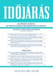

Quarterly Journal of Hungarian Meteorological Service

Special issue: Climate change and adaptation
Guest Editor: Rita Pongrácz

letöltés [pdf: 3571 KB]
Return values of 60-minute extreme rainfall for Hungary
Mónika Lakatos, Beatrix Izsák, Olivér Szentes, Lilla Hoffmann, Andrea Kircsi, and Zita Bihari
DOI:10.28974/idojaras.2020.2.1 (p. 143–)
 PDF (2197 KB)   |   Abstract

The rainfall intensity for various return periods are commonly used for hydrological design. In this study, we focus on rare, short-term, 60-minute precipitation extremes and related return values which are one of the relevant durations in the planning and operating demands of drainage and sewerage systems in Hungary. Time series of 60-minute yearly maxima were analyzed at 96 meteorological stations. To estimate the return values for a given return period, the General Extreme Value (GEV) distribution was fit to the yearly maxima. The GEV fit and also the Gumbel fit (GEV Type I.) were tested. According to the goodness of fit test results, both GEV and Gumbel distributions, are adequate choices. The return values for 2, 4, 5, 10, 20, and 50 year return periods are illustrated on maps, and together with their 95% confidence intervals, are listed in tables for selected stations. The maps of return values demonstrate that the spatial patterns of the return values are similar, although the enhancing effect of orography can be explored in the Transdanubia region and in the North Hungarian Range. As the return period is increasing, so the range of the confidence are widening as it is expected.


Multi-scenario and multi-model ensemble of regional climate change projections for the plain areas of the Pannonian Basin
Anna Kis, Rita Pongrácz, Judit Bartholy, Milan Gocic, Mladen Milanovic, and Slavisa Trajkovic
DOI:10.28974/idojaras.2020.2.2 (p. 157–)
 PDF (8857 KB)   |   Abstract

This study is focusing on the projected temperature and precipitation changes in the plain areas of Serbia and Hungary. The simulated changes are calculated for two future time periods (namely, 2021‒2050 and 2069‒2098) on a monthly scale, and they are compared to the 1971‒2000 reference period. In order to estimate the uncertainties deriving from different sources, 10 RCM simulations driven by different GCMs, and three RCP scenarios (RCP2.6, RCP4.5, and RCP8.5) were taken into account. According to the obtained results, higher temperature values are likely to occur in the future, and warmer conditions tend to occur if greater radiative forcing change is assumed. In the case of precipitation, larger variability emerges, but for July, a clear decreasing trend is projected, especially in the case of RCP8.5; while from October to June an increase is projected by most of the RCM simulations. Rainfall variability index shows that the number of dry years will be 5–20 from 30-year time series in the mid-century, and slightly less in the late-century. Extreme dry conditions will tend to occur in 2–12 years overall during 30-year future time periods in the northern plain subregions, and somewhat more frequently in the southern subregions (i.e., in Serbia). The obtained results do not show substantial differences depending on the RCP scenarios, since the scenario plays a less important role in the overall uncertainty of climatic projections compared to the model physics and parameterizations or the internal climatic variability.


Modeling the urban climate of Budapest using the SURFEX land surface model driven by the ALADIN-Climate regional climate model results
Gabriella Zsebeházi and Gabriella Szépszó
DOI:10.28974/idojaras.2020.2.3 (p. 191–)
 PDF (3502 KB)   |   Abstract

Urbanized areas modify the local climate due to the physical properties and morphology of surface objects. The urban impacts on local scale interact with the regional climate resulting in an amplification of certain climate aspects in the cities (e.g., higher maximum air temperature), which may be further enhanced with climate change. Regional climate models provide adequate tool for assessing the regional characteristics of global changes, however, they are incapable for describing the local impacts, e.g., in cities, due to their relatively low resolution (usually 10–25 km horizontally) and due to the lack of detailed description of relevant physical processes. To investigate the future climate change in cities, surface models provide a scientifically sound and cutting-edge solution for the previous problem. In this study, the behavior of SURFEX externalized land surface model including the TEB urban canopy scheme and coupled to the ALADIN-Climate regional climate model in offline mode is investigated. A 10-year-long simulation for 2001–2010 was achieved on 1 km resolution for Budapest. The main goals of our investigation are i) to assess how the biases of the regional climate model inherited and modified by SURFEX, ii) what is the added value of SURFEX to ALADIN-Climate, and iii) what are the capabilities of SURFEX in terms of describing urban and suburban seasonal temperature cycle and daily urban heat island (UHI) evolution in Budapest. Quantified validation is conducted using the measurements of two stations located in the city center and in the suburban area. It was found that SURFEX overestimates the 2 m temperature in both locations throughout the year, in spite of the too cold ALADIN forcings. The strength of nocturnal UHI is overestimated from autumn till spring, while it is slightly too weak in summer. Moreover, the evolution and collapse of daily UHI is imperfectly simulated, namely some delay and slower daily dynamics occur, which might be caused by the method applied for deriving the atmospheric forcings.


Estimation of agro-ecosystem services using biogeochemical models
Klára Pokovai, Roland Hollós, Emese Bottyán, Anna Kis, Tibor Marton, Rita Pongrácz, László Pásztor, Dóra Hidy, Zoltán Barcza, and Nándor Fodor
DOI:10.28974/idojaras.2020.2.4 (p. 209–)
 PDF (1408 KB)   |   Abstract

Agro-ecosystem services are the various benefits (e.g., crop yield) that people freely obtain from the properly functioning agricultural lands. The estimated changes in climatic conditions including increasing temperature, with particular attention to the summer means, together with the expected changes in the temporal precipitation distribution pose enormous challenge to the agriculture. Currently, dynamic system models are most frequently used tools that are capable of estimating the prospective effects of climate change on agro-ecosystems. A deterministic biogeochemical model is presented that is developed by Hungarian scientists within the framework of the AgroMo project. The main goal of the AgroMo project is to develop climate-smart strategies in order to mitigate the effect of potential future hazards in the context of climate change by 1) creating a complex, state-of-the-art experimental platform; 2) producing ten new, 0.1° spatial resolution climate scenarios based on the RCP (Representative Concentration Pathway) 4.5 and RCP8.5 scenarios; 3) developing an integrated assessment and modeling framework that is capable of simulating every major land use types; 4) analyzing/simulating a great number of adaptation strategies that can be used to support decision makers. Based on the preliminary simulation results, climate change will most likely expose significant negative impact on the spring sown crops in Hungary. Although, the yield losses could be avoided with irrigation or could be mitigated with earlier sowing, the role of winter crops is likely to become more significant in Hungary in the future.


Changing climatic sensitivity and effects of drought frequency on the radial growth of Fagus sylvatica at the xeric frontiers of Central Europe
Balázs Garamszegi, Miklós Kázmér, László Kolozs, and Zoltán Kern
DOI:10.28974/idojaras.2020.2.5 (p. 227–)
 PDF (3987 KB)   |   Abstract

The influence of climate on the vitality and growth of European beech (Fagus sylvatica L.) has become a focus of forest research over the last decade. Beech locally reaches its continental xeric limit in Hungary within its European distribution area, giving a unique opportunity to study the climatic sensitivity of the species, based on tree-ring analysis. A comparison of four geographically and climatically different sites is presented from Hungary, combining data collected on stand level with systematic forest inventory plots. Tree-ring width chronologies covering the past 90–100 years of the lifetime of mature and middle-aged trees and different climatic variables were used to evaluate the growth-climate relationships and recent growth trends of the selected beech stands by multivariate regression analysis. Strong relationships were found between annual radial growth and (mainly water availability related) meteorological variables of the vegetation season, exceeding previous results from elsewhere in Europe. A clear spatiotemporal variability of the growth sensitivity was also revealed, following a (climatic) gradient from the northern to the southwestern parts of the country. In the northern sites, climatic sensitivity was found to be more fluctuating, while southwestern sites facing more continuous effects of changing climatic conditions seem to show weakening correlation over time. Trends of relative basal area increments and climatic sensitivity of growth over the past decades may be due to unfavorable climatic changes, though extreme and recurrent drought events superimposed on the long-term trends seem to have a decisive impact on growth patterns and associated resilience of beech.


Hungarian regions and cities towards an adaptive future – analysis of climate change strategies on different spatial levels
Mária Szalmáné Csete and Attila Buzási
DOI:10.28974/idojaras.2020.2.6 (p. 253–)
 PDF (1137 KB)   |   Abstract

Nowadays, urban areas are increasingly identified as strategic fields of climate change-related actions. Climate change is an increasingly complex challenge for these territories. Tackling climate change, moreover, in a sustainable way, is a priority in the European Union, which has set several ambitious short- and long-term mitigation, adaptation, and sustainability targets. It is a central issue of how society can respond to the climate emergency that is affected by and depends on the vertical and horizontal interrelations among different stakeholders, organizations, governance actors, etc., and their activities. Countries, regions, counties, and cities around the world react by developing climate strategies. The operationalization of the high-level political agreements and discourses is uncertain, and the policies in practice should also be evaluated on regional and city levels, just as the milestones of related strategic planning processes fostering local adaptive capacity. According to regional and urban governance, it is pivotal addressing not only mitigation but adaptation issues to be able to foster sustainable regional development, also considering the UN Sustainable Development Goals (SDGs) specified in the Agenda 2030. Adaptation to climate change is increasingly becoming a priority for policy action. It also has high relevance to find the synergic interrelations towards an adaptive future. This paper evaluates the recent changes in Hungarian regional and urban planning in relation to climate policy approach and reports a state of adaptation oriented spatial planning on NUTS-3 (Nomenclature of Territorial Units for Statistics) and LAU-1 (Local Administrative Units) levels. The results are based on the collection of all relevant climate change-related strategic documents on these levels in Hungary and on the analysis of specific information. There is a lack of knowledge related to the comprehensive adaptation policy and planning on regional and local levels in Hungary. The results of the evaluation show the state-of-art knowledge related to possible adaptation pathways and the various engagement level for climate policy approach on different spatial levels in Hungary. In the case of the examined research area, the development of more mitigation oriented planning documents and low level of adaptation measures and monitoring process management tools is seen as critical.


Validating AquaCrop model for rainfed and irrigated maize and soybean production in eastern Croatia
Monika Marković, Marko Josipović, Milena Jančić Tovjanin, Vladimir Đurđević, Marija Ravlić, and Željko Barač
DOI:10.28974/idojaras.2020.2.7 (pp. 277–297)
 PDF (767 KB)   |   Abstract

In this study, the AquaCrop model was used to quantify climate change impact on yield and net irrigation in maize and soybean production. Daily observed climate data (1961–1990) from Osijek weather station were used for past climate simulation, and output data from ECHAM model were dynamically downscaled under two IPCC SRES scenarios (A1B, A2) for two integration periods 2041–2070 and 2071–2100. The soil properties and crop data were presented from 6-year-long (2010–2015) field study of the Agricultural Institute in Osijek, Osijek-Baranja County. The climate results showed expected rise in air temperature up to 5 ºC and significantly lower precipitation up to 43.5%. According to results from the AquaCrop model, there is no change in maize yield in non-irrigated conditions, while in irrigated conditions there is a yield increase of 1.4 t ha-1 of dry matter (dm), with 80 mm higher net irrigation in comparison with the 1961–1990 period. As for soybean production, the increase in yield is expected in both non-irrigated and irrigated conditions. The yield increases up to 1.9 dm t ha-1 in irrigated conditions with 90 mm higher net irrigation in comparison with the 1961–1990 period. As for crop water indices, in non-irrigated conditions the water use efficiency (WUE) has a trend to decrease in the future, while in irrigated conditions it can slightly increase. Irrigation water use efficiency (IWUE) showed significantly higher increase in irrigated maize and soybean production.


On the reliability of CALPUFF and AUSTAL 2000 modeling systems regarding smoke and vapor plume mergence
Pedram Jafari Shalkouhi, Farideh Atabi, Faramarz Moattar, and Hossein Yousefi
DOI:10.28974/idojaras.2020.2.8 (p. 299–)
 PDF (2824 KB)   |   Abstract

Observations at power plants have shown that smoke plumes from stacks frequently merge with vapor plumes from cooling towers. Wind speed and direction play a key role in merging vapor and smoke plume. Mergence of stack and cooling tower plume leads to formation of undesirable substances such as sulfuric acid aerosols, acid mist, and acid fly ash. The present study shows that smoke and vapor plume mergence is a common phenomenon in Mátra power plant in Hungary; however more studies must be conducted in the future to reveal the type and number of plume mergence in the mentioned plant. The present work also indicates that the CALPUFF and AUSTAL 2000 modeling systems cannot provide enough information with regard to vapor and smoke plume mergence.


IDŐJÁRÁS folyóirat