Climate analyses of the most recent climatological normal period (from 1991 to 2020) is performed on completed, quality-controlled and homogenized (MASH) databases of the Hungarian Meteorological Service.
In order to ensure a consistent spatial coverage, we interpolate the station values on a dense, regular grid with an interpolation method named MISH, which was developed specifically for meteorological purposes, so we can analyze the climate and its possible changes for the country as a whole.
While in the case of temperature and precipitation the analyses are based on the data of the 30-year-period between 1991 and 2020, due to the significant changes in the measurements we examined the years between 2001 and 2020 in the case of global radiation and wind.
Since the Hungarian Meteorological Service stopped measuring the sunshine duration in the 2010s, the duration of the sunshine was derived from satellite measurements.
We have data from different number of stations for different meteorological elements.
| Meteorological element | Number of stations |
| Temperature (1971-1974) | 55 |
| Temperature (1975-2020) | 114 |
| Precipitation | 500 |
| Wind speed and direction | 89 |
| Global radiation | 37 |
Table 1
Number of meteorological stations used for different elements
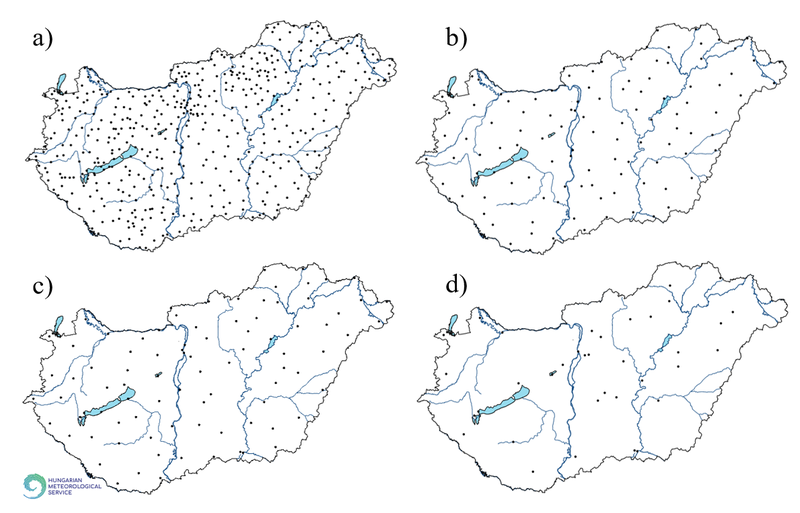
Figure 1
Location of stations for measurement of precipitation (a), temperature (b), wind (c) and global radiation (d) in Hungary
Territorial averages are presented in several cases, which represent the average of the interpolated grid point values, not the average of the station values. This is necessary because the location of the meteorological stations is not equally distributed within the country (e.g. there are much fewer stations in the higher areas), therefore the station average does not properly represent the entire area of the country.