2024. november 24. vasárnap
IDŐJÁRÁS - angol nyelvű folyóirat

Vol. 122, No. 1 * Pages 1–99 * Januar - March 2018
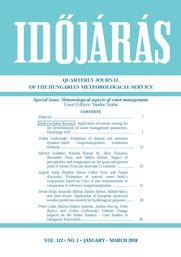

Quarterly Journal of the Hungarian Meteorological Service

Special Issue: Meteorological aspects of water management

letöltés [pdf: 2680 KB]
Application of remote sensing for the determination of water management parameters, Hydrology SAF
Judit Gerhátné Kerényi
DOI:10.28974/idojaras.2018.1.1 (p. 1–)
 PDF (5594 KB)   |   Abstract

DOI:10.28974/idojaras.2018.1.1

The European Organisation for the Exploitation of Meteorological Satellite (EUMETSAT) established the Satellite Application Facility on Support to Operational Hydrology and Water management (H-SAF) on July 2005. The aim of the H-SAF is to derive parameters which are important for hydrology, for hydrological models. H-SAF derives precipitation, soil moisture, and snow products based on satellite information, and makes hydrological validation. The Hungarian Meteorological Service takes part in the product validation work.
In this paper we describe the different products, then the validation activities are shown including some examples.


Validation of diurnal soil moisture dynamic-based evapotranspiration estimation methods
Zoltán Gribovszki
DOI:10.28974/idojaras.2018.1.2 (p. 15–)
 PDF (788 KB)   |   Abstract

DOI:10.28974/idojaras.2018.1.2

Evapotranspiration (ET) is one of the most important elements of water balance. Despite its importance, exact determination for a mosaic surface cover is very limited; therefore, there is a demand for relatively simple and cheap methods of determination that work on a small spatial scale.
Water uptake of forest vegetation in groundwater discharge areas generally has a strong influence on the water resources induced diurnal signal in soil moisture, and in the water table. Diurnal methods in a shallow groundwater environment are widely used nowadays for ET estimation.
By modifying the well-known White (1932) method and adapting to soil moisture data, a new technique was developed to calculate ET from soil moisture readings, eliminating the need of specific yield (a weakest point of the groundwater signal based methods). The new method was validated using hydro-meteorological data of the Hidegvíz Valley experimental catchment located in the Sopron Hills at the western border of Hungary.
The 30-min ET rates of the proposed method lag 30-60 minutes behind those of the reference Penman–Monteith method, but otherwise the two estimates compare favorably.
On a daily basis, the newly derived ET rates are very close to PM estimates, but on average, they are 38% higher than the ones obtainable with the original White method. Comparing the ET rates of the proposed method with traditional ET estimates from soil moisture, a significant difference can be ascertained.
The proposed method has potential benefits in groundwater discharge areas, especially in light of the changing climate with its warmer and drier growing seasons, that will likely result in limited water resources.


Impact of precipitation and temperature on the grain and protein yield of wheat (Triticum aestivum L) varieties
Márton Jolánkai, Katalin Kassai M., Ákos Tarnawa, Barnabás Pósa, and Márta Birkás
DOI:10.28974/idojaras.2018.1.3 (p. 31–)
 PDF (615 KB)   |   Abstract

DOI:10.28974/idojaras.2018.1.3

Impacts of agronomic applications were studied in a field experiment to determine water availability, grain yield, and protein formation interrelations. Three winter wheat varieties and six nitrogen application levels were applied in two consecutive crop years representing different precipitation and temperature patterns to evaluate yield, yield components, and quality manifestation. The research results suggest that precipitation patterns in relation with the wheat development phenophases had profound influence on the grain yield and protein formation of wheat crop. Varietal differences were determined regarding yield and protein values in relation with plant nutrition and crop year impacts. There were no, or minor differences only between varieties, however plant nutrition treatments induced significant differences in both crop years.


Estimation of natural water body’s evaporation based on Class A pan measurements in comparison to reference evapotranspiration
Angéla Anda, Brigitta Simon, Gábor Soós, and Tamás Kucserka
DOI:10.28974/idojaras.2018.1.4 (p. 41–)
 PDF (1227 KB)   |   Abstract

DOI:10.28974/idojaras.2018.1.4

A Class A pan (C) evaporation (Ep) study was conducted at the Agrometeorological Research Station of Keszthely, in the growing season of 2016. Some of the evaporation pans were implemented with freshwater aquatic macrophytes (Myriophyllum sp., Potamogeton sp.,and Najas sp.) (Ps) and sediment covered bottom (S). The applied macrophytes were the predominant species of Keszthely Bay (Balaton Lake). Reference (Eo) afterShuttleworthand reference evapotranspiration (ETo) after Penman-Monteith (FAO-56 formula) were also included for the E study. Of pre-selected four investigated variables, air temperature and air humidity impacted Ep of treated Class A pans the most. Cumulative Ep values for 2016 were 363.1, 427.7, and 461.5 mm in C, S, and Ps, respectively. There was no difference in measured cumulative Ep of Ps (461.5 mm) and computed ETo (472.1 mm) during the studied season.
On the basis of a simplified water budget, E rate of Keszthely Bay increased with 16.9%, when macrophytes and sediment cover were accounted. It is equivalent to 264,000,000 m3 water in Keszthely Bay’s E estimation. Simple E approach - when lake’s components, such as submerged macrophytes and sediment cover were also accounted - could extend the accuracy of natural lake’s E estimation in a broader circle than earlier.


Application of European numerical weather prediction models for hydrological purposes
István Ihász, Amarilla Mátrai, Balázs Szintai, Mihály Szűcs, and Imre Bonta
DOI:10.28974/idojaras.2018.1.5 (p. 59–)
 PDF (2154 KB)   |   Abstract

DOI:10.28974/idojaras.2018.1.5

Nowadays, hydrological forecasts are based on wide range of meteorological inputs, including observations and forecasts. In this paper four main areas are covered. First of all, milestones covering last four decades from usage of a simple statistical method to regional limited area modeling are summarized. Then an overview of the main activities of the European Flood Awareness System (EFAS) is given. Usage of ensemble forecasts for providing uncertainty is getting larger and larger attention for hydrological applications too. Benefits of a locally developed new tool, the ensemble calibration method based on reforecast model climate is given in the third part. Finally, local developments on regional hydrostatic and non-hydrostatic models are shown. It is shown that a high resolution limited area non-hydrostatic model can predict summer heavy precipitation more accurately.


Climate change impacts on the water balance - case studies in Hungarian watersheds
Péter Csáki, Márton Miklós Szinetár, András Herceg, Péter Kalicz, and Zoltán Gribovszki
DOI:10.28974/idojaras.2018.1.6 (p. 81–)
 PDF (3934 KB)   |   Abstract

DOI:10.28974/idojaras.2018.1.6

Climate change will alter various components of the water balance on global, regional, and local scales; these changes will be measurable mainly through alterations of the spatial distribution and temporal trends of temperature, precipitation, and evapotranspiration. We analyzed the water balance of two Hungarian watersheds (Zala and Bácsbokodi-Kígyós) based on a spatially distributed robust hydrological model that was calibrated using actual evapotranspiration values of CREMAP (Complementary-relationship-based Evapotranspiration Mapping Technique). During the model calibration period (2000‒2008), evapotranspiration (ET) and runoff (or recharge, R) were 92% and 8% of the precipitation amount in the Zala watershed, while in the Bácsbokodi-Kígyós watershed it was 75% and 25%. A climate-runoff model was developed to evaluate the effects of climate change on the water balance. Long-term ET and R averages can be calculated applying a spatially distributed Budyko-model at a resolution of 1 km × 1 km. In the case of the surplus water affected areas where ET exceeds precipitation, ET and R can be calculated with another simple model that works on the analogy of pan evaporation. Using precipitation and temperature results of regional climate model simulations as input data, we calculated the projections of the main components of the water balance. Increasing temperatures in the 21st century are projected to cause a slight increase in evapotranspiration relative to the reference period 1981‒2010; this may cause a substantial reduction of long-term runoff. The mean decrease can exceed 53% for the Zala and 38% for the Bácsbokodi-Kígyós watersheds. The decreasing runoff/recharge could limit manageable or extractable groundwater resources, alter agricultural activities, and cause a water deficit in Balaton Lake.


IDŐJÁRÁS folyóirat